
Currently to cruise from Whittlesey to the Great Ouse, on the Middle Level one has three options.
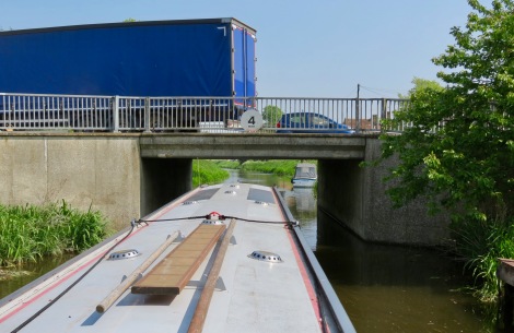
First Left, (north) up the Twenty Foot River, by-passing March. This is the shortest yet least interesting route, however more importantly it has three low bridges the most critical being Infield’s Br (67) @ 5′-2″ which precludes the passage of most non local craft.
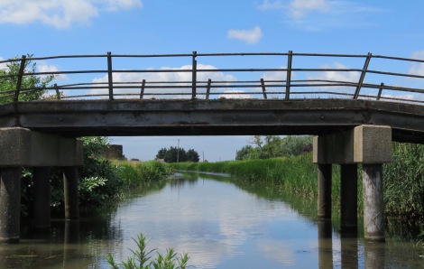
 Infields Br (67) on the 20ft Drain.
The second involves turning right (south) at the Old River Nene and taking the Chatteris Ring Whittlesey Dyke & Old R Nene to Ramsey Dock, Middle Level. via Benwick. This is definately the most interesting and currently the least resourced route with two low bridges having a headroom of 6′-4″ (White Fen (48) & Bedlam (17).
The third and currently recommended through route (RTR) continues on through March, then on to Well Creek before which the two alternatives routes rejoin the RTR so both Upwell and Outwell are included in all options.
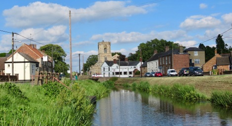
As the RTR runs along what was the original natural line of the old River Nene it is definately the most picturesque of the three options. From a boaters point of view this is also the most resourced, having two Marinas and the town of March with its railway station and High Street shops.
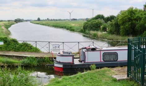
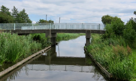
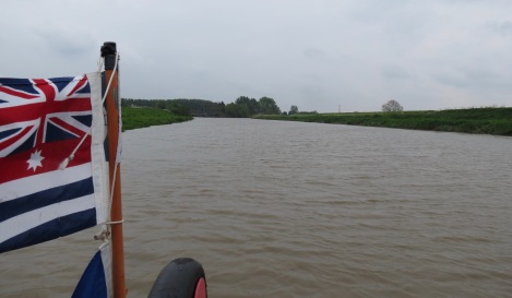
From Floods Ferry Junction to Marmont Priory our journey was through open country and past Floods Ferry Marina, the first on-line marina after Stanground Lk.
This was the busiest section of our Middle Level trip and we noticed that several oncomming larger boats turned just before, School Farm Br (45) and returned to March.
On checking the MLCG we found that it gave the maximum headroom for this section as 6′-4″ but did not say at which bridge, so we had no idea of its headroom.
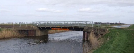
 The remains of School Farm or Whittlesey Rd Bridge (45)
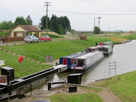
Approaching March we came across the large off line Fox’s Marina.
Charlie Fox, a traditionally trained boatbuilder was the driving force behind the reinvigoration of boating on the Middle Level Navigations, including the restoration of Well Creek which was being threatened by official neglect and road building in the 1960’s and 70’s.
 Fox’s Marina. In 1980 he personally excavated this mooring basin, then steadily developed it into a thriving boat building yard, hire boat base and the current 200 berth Marina.
From Fox’s Marina to March Town Centre and its High Street the navigation runs through a gentle cutting which is covererd in Forty Foot, Sixteen Foot Drain, & New Popham’s Eau to March
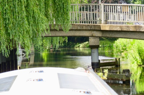
After March the river runs through wide open fields of wind turbines until it comes to Marmont Priory Lock, originally only large enough to take traditional Fen Lighters of about 42′-0″ long. It was enlarged in to take craft up to about 92 feet.
With careful positioning craft with roof projections will be able to pass under the low bridge which would appear to be about 6′-9″. The MLCG gives no advice but Mrs Norton (Tel 07824 821737) the keeper should be able to advise.
The Norton family were also prominent in campaigning for the preservation of Well Creek.
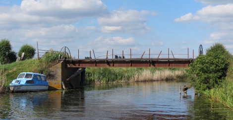
 Marmont Priory Lock and Br 39, from the March side. It has an interesting selection of paddles.
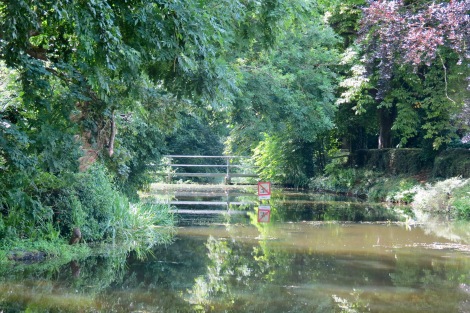
From this point on, almost all the bridges to Salters Lode Lk are very low so Marmont Priory Lk is a good place to remove any last remaining roof top projections.
 Hall Br (37) this felt lower than the bridges highlighted in the MLCG but then so did many others all the way to the Great Ouse.
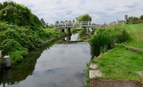
 Upwell Methodist Chapel Footbridge (36) 6′-7″ headroom.
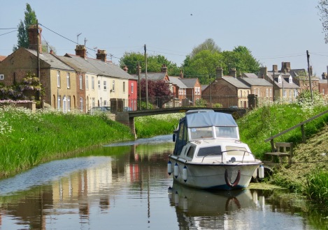
From Upwell Chapel FB, Well Creek is lined on both sides with a mix of substantial buildings and several shops it also has a number of small landings including two adjacent to the local supermarket and bus stop for Wisbech.
On both visits we used this as our stop rather than the more luxurious moorings at Church Br which can fill early in the day.
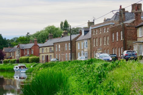 Some of the more substantial buildings which line the navigation.
As one passes through Upwell one can’t help wondering if Ramsey’s Main Street would have looked like this before the Ramsey Tunnels were built.
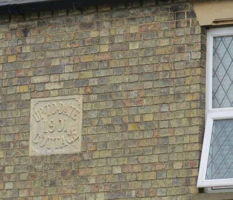 Not all the buildings are substantial but the plastic windows would suggest this one is trying to keep up-to-date!!!
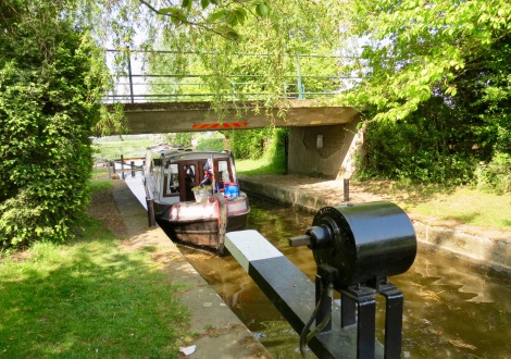
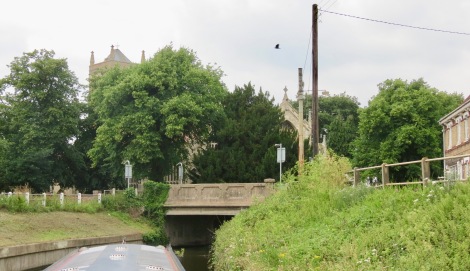
 Upwell Church Br (35) 6′-5 headroom with the magnificent St Peters Church in the background. The MLCG gives this as “THE” low bridge on the RTR. The moorings are on the right just past the bridge.
 St Peters Road, Upwell
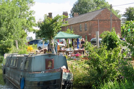
On our return journey we awoke to find that the streets on both sides of the creek were full of people disappearing into front gardens and round the back of old chapels (of which there are many) with great intent.
As time passed the whole riverside morphed into a linier Flee Market which we found to be a regular Sunday event and was great fun.
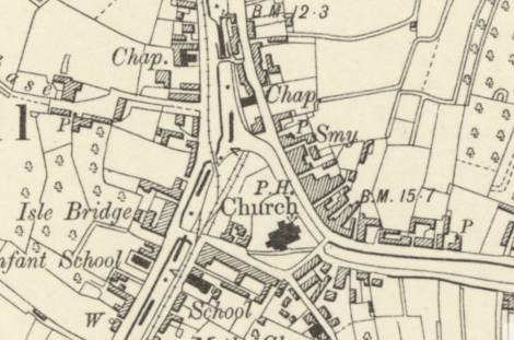
 Isle Br (33) with its 1652 Key Stone, another low bridge, the old entrance to the Wisbech Canal can just be seen through the bridge on the left.
 Toby & frends on the Wisbech and Upwell Tramway about 1900 near Isle Bridge.
 The hairpin bend and moorings where the Wisbech canal entered through a lock on the left of the park bench.
This area can be congested as the visitor moorings provided on the left of the bend act as an overflow mooring to the St Peters moorings and a variety of GRP boats can be moored on the end of garden moorings on the right.
Braggabout is passing exactly where a skew bridge took the W&UT over the river to the St Clements Halt.
In addition to the Holt, Church Sidings, fed a number of coal chutes with loaded barges which distributed coal through out the local canal system.
 The junction with the Wisbech canal and its first lock. The line of the W&UT. & its coal tips can also be seen.
Re excavating the entrance below the lock would make a great landscape feature for the village and ideal additional moorings for visiting boats. With a bus trip to Wisbech. Upwell is defiantly a two night stop.
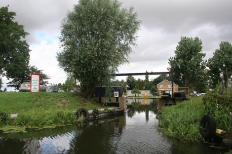
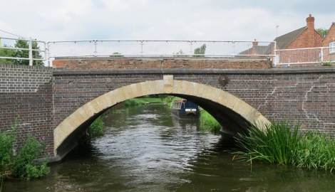
 The 1930’s R Concrete, Swan Bridge (32) marks the end of the rivers hairpin bend.
 Mullicourt Aqueduct (126) built in the 1840’s over the then new, Middle Level Main Drain looking back down the MLMD to Popham’s Eau.
 Mullicourt Br (27) adjacent to the Aqueduct.
Newton Bridge (29) just before the Popham’s Eau overflow.
 The overflow from Well Creek down into the end of Old Popham’s Eau.
 Nordelph Bridge (28)
Nordelph appears to have some interesting spots worth investigating however we could not see any legitimate public moorings in the village or anywhere between Br 28 and Salters Lode, so we did not stop.
This would appear to be a lost opportunity for the village shop.
I assume it has one?
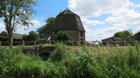 The remains of Nordelph Smock Mill, one of two old wind pumps which drained Nordelph Fen into Well Creek, the outlet can still be seen in the bank.
 Frays Farm Br (27)
This is probably the first of the low bridges when coming from the Great Ouse.
However no headrooms are given in the MLCG for visitors to Upwell, between Slaters Lode and Church Bridge in Upwell. So the trip would be something of an unknown quantity for boats coming from the Great Ouse.
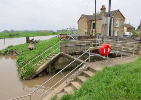
 Salters Lode Lock moorings. The bridge in the background crosses the Old Bedford River which runs back up to Walshes Dam Lk and Mepal.
By the time the tide had risen enough for us to pass through the lock we had been joined by three hire boats on their way to Ely making eight boats in total so after the first two boats had passed through singly the others went two by two.
 The Great Ouse tunnel like entrance through the flood bank and into the MLC lock.
On our return, this structure itself was not visible from the river until one is adjacent to it, so one has to look out for the rubber tyres which mark the entrance to the run in.
The lock house is visible of course.
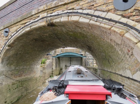 Entering Salters Lode Lock
I always find these old tidal locks with their vaulted arches somewhat intimidating as one is never certain just when the roof will stop getting closer. That said I have always found the keepers to be extremely experienced and helpful.
 Out on the open tidal Great Ouse for the half mile trip up to Denver Sluice which is just visible through the light mist.
Navigation Guide
For the Middle Level Navigations we used the Waterway Routes, Middle Level Map which we found to be excellent. We understand a new version will be available for 2018.
Conclusion
This is definitely the most interesting section of the Middle Level and we would certainly recommend taking the bus into Wisbech from Upwell to round things off.
The town has much to offer and the bus route runs along the line of both the Tramway and the Wisbech Canal which also run parallel to each other.
Trying to identify the remaining landscape evidence of these long gone transport modes as the bus criss crosses the lines is a totally absorbing experience in its own right. It alone more than justifies the trip for any true Anorak.
Good moorings in the centre of Nordelph would make it great location for craft awaiting a tide. (the current historic mooring is outside the town).

Another smashing blog. I agree with you that Wisbech is well worth a visit. Even more fun is to go by narrowboat …..
Pingback: Old Bedford River Campaign Cruise Aug 2018 with the IWA - Braggaboutlife·